Address
EQCIL0nDeaV-vC3kEYRd06R_OOhIlOI8FtQ5Fdtt3Ub1KdjB
EQCIL0nD…3Ub1KdjB
Balance
0.0349924 TON
≈ $0.13144
Contract type
nft_item
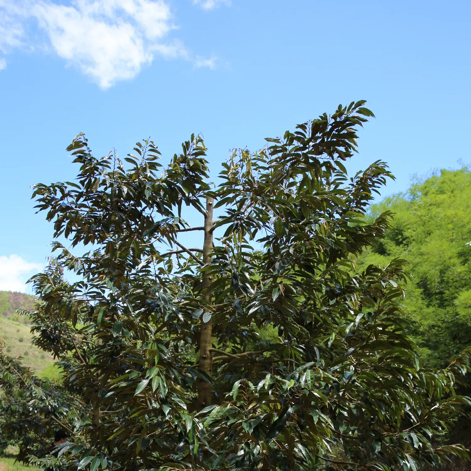
Dam Rong Durian TON Farm
EQBX…_zdl · 150 items

Getgems
vn010006
Owner
Collection
Dam Rong Durian TON Farm
Collection Address
Attributes
Latitude
Latitude 12.170411 N 12°10'13.47840"
Longitude
Longitude 108.163668 E 108°9'49.20630"
Cultivar
Monthong
Age
40
Branch
23
Metadata
{
  "cultivar": "Monthong",
  "lottie": "",
  "bough": 23,
  "owner": null,
  "long": "Longitude 108.163668 E 108°9'49.20630\"",
  "name": "vn010006",
  "image": "https://pub-49e78d1226f648eb9f101e1f0ce5eabc.r2.dev/NQT_2803.JPG",
  "attributes": [
    {
      "trait_type": "Latitude",
      "value": "Latitude 12.170411 N 12°10'13.47840\" "
    },
    {
      "trait_type": "Longitude",
      "value": "Longitude 108.163668 E 108°9'49.20630\""
    },
    {
      "trait_type": "Cultivar",
      "value": "Monthong"
    },
    {
      "trait_type": "Age",
      "value": 40
    },
    {
      "trait_type": "Branch",
      "value": 23
    }
  ],
  "images": [
    "https://pub-49e78d1226f648eb9f101e1f0ce5eabc.r2.dev/NQT_2803.JPG",
    "https://pub-49e78d1226f648eb9f101e1f0ce5eabc.r2.dev/NQT_2799.JPG"
  ],
  "content_type": "",
  "age": 40,
  "content_url": "",
  "description": "",
  "lat": "Latitude 12.170411 N 12°10'13.47840\" "
}
How this data was fetched?
Use tonapi.io