Address
EQAtMUU_ctV1ZDJELxkiFaedwjTT8Zv0hTZ1tZda-OdgRhgq
EQAtMUU_…-OdgRhgq
Balance
0.0349924 TON
≈ $0.13157
Contract type
nft_item
Dam Rong Durian TON Farm
EQBX…_zdl · 150 items

Getgems
vn010059
Owner
Collection
Dam Rong Durian TON Farm
Collection Address
Attributes
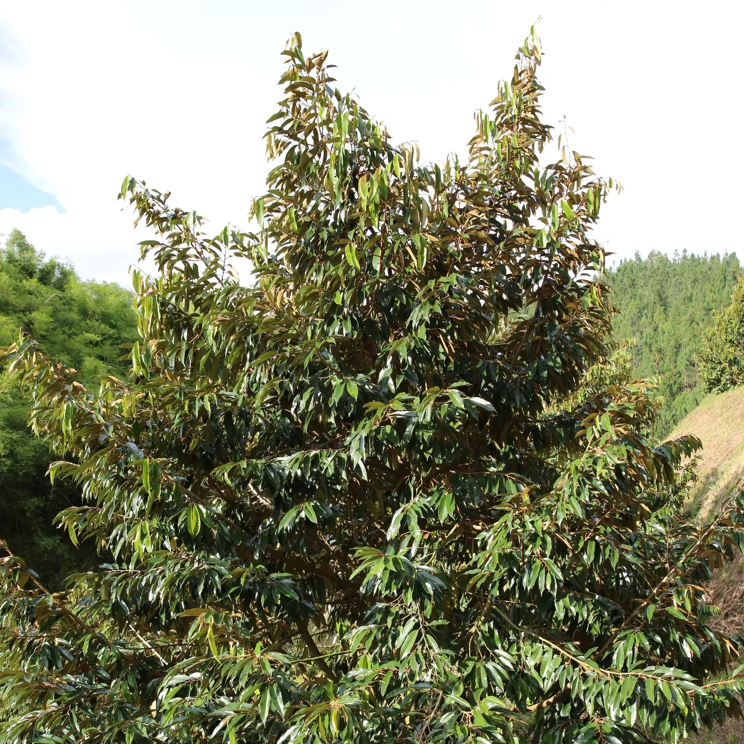
Latitude
Latitude 12.170189 N 12°10'12.68030"
Longitude
Longitude 108.163148 E 108°9'47.33310"
Cultivar
Monthong
Age
40
Branch
24
Metadata
{
  "bough": 24,
  "lottie": "",
  "owner": null,
  "content_type": "",
  "description": "",
  "attributes": [
    {
      "trait_type": "Latitude",
      "value": "Latitude 12.170189 N 12°10'12.68030\" "
    },
    {
      "trait_type": "Longitude",
      "value": "Longitude 108.163148 E 108°9'47.33310\""
    },
    {
      "trait_type": "Cultivar",
      "value": "Monthong"
    },
    {
      "trait_type": "Age",
      "value": 40
    },
    {
      "trait_type": "Branch",
      "value": 24
    }
  ],
  "cultivar": "Monthong",
  "name": "vn010059",
  "age": 40,
  "image": "https://pub-49e78d1226f648eb9f101e1f0ce5eabc.r2.dev/NQT_2947.JPG",
  "content_url": "",
  "images": [
    "https://pub-49e78d1226f648eb9f101e1f0ce5eabc.r2.dev/NQT_2947.JPG",
    "https://pub-49e78d1226f648eb9f101e1f0ce5eabc.r2.dev/NQT_2946.JPG",
    "https://pub-49e78d1226f648eb9f101e1f0ce5eabc.r2.dev/NQT_2945.JPG"
  ],
  "long": "Longitude 108.163148 E 108°9'47.33310\"",
  "lat": "Latitude 12.170189 N 12°10'12.68030\" "
}
How this data was fetched?
Use tonapi.io